FAIR is a non-profit organization dedicated to providing well-documented answers to criticisms of the doctrine, practice, and history of The Church of Jesus Christ of Latter-day Saints.
mNo edit summary |
mNo edit summary |
||
| Line 1: | Line 1: | ||
{{BoMGeoTableStart}} | |||
{{BoMGeo:Poulsen 2004_RAW}} | |||
|} | |||
{| <!--Second table; can probably start any additional text below it--> | {| <!--Second table; can probably start any additional text below it--> | ||
|- | |- | ||
| Model Name | Date Proposed | Scope | Narrow Neck | Land North | Land South | Cumorah | River Sidon | Nephi's Landing | Religion | Type of model
Model name: Poulsen 2004Date proposed: 2004 |
|---|
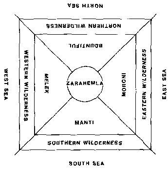
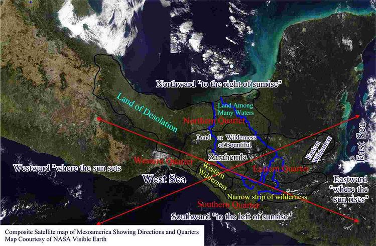
| Lawrence Poulsen, stimulated by the models proposed by Sorenson and Hauck, used his own study of the text, combined with advances in 3-D computer mapping technology and satellite maps to provide a fascinating refinement of the Mesoamerican model.[3] Poulsen compares Sorenson's River of Sidon suggestion (the Grijalva River) with Hauck's (the Usamacinta River) and finds Grijalva much more plausible.[4] Poulsen extends this analysis to show how the explorers mentioned in Mosiah 8꞉7-10 likely mistook Usamcinta for Sidon/Grijalva, thus becoming hopelessly lost. The Book of Mormon text is even accurate in the direction which the Sidon flows at a critical point.[5] Furthermore, Poulsen suggests the use of a "quadrant"-based directional system as used by some Mesoamerican groups,[6] as opposed to arguing that the Nephites used cardinal directions off-set from magnetic north, as Sorenson does.[7] Clark's review of Hauck contained a similar suggestion that the Nephites conceptualized their world in a quadrant-based fashion (see image at right).
|
 |
 |

FAIR is a non-profit organization dedicated to providing well-documented answers to criticisms of the doctrine, practice, and history of The Church of Jesus Christ of Latter-day Saints.
We are a volunteer organization. We invite you to give back.
Donate Now